The Federal Aviation Administration (FAA) is making progress toward defining use of Small Unmanned Aerial Systems (sUAS) with the recent release of a Notice of Proposed Rule Making. The NPRM calls to integrate and regulate commercial use of sUAS into the national airspace. A comment and amendment period follows. Regulations could be confirmed in another 18 to 24 months.
With these definitions on the horizon, the future of remote sensing appears to be robust. With new applications rolling out every day, retailers and suppliers are learning how to implement even as the technology and rules develop.
Progression of Technology and Aerial Platforms
The sUAS (Small Unmanned Aerial System) industry is moving at lightning speed to develop the hardware and software that will fit practical agricultural applications. Numerous aerial platforms and crop sensors have emerged on the market. As with any technology selection, growers and retailers should start with a specific end in mind. The technology use should lead to actionable farm management decisions.
Several vehicle, sensor and software options are on the market, with the ability to overfly an area of interest collecting different layers of data, based on the information desired. Sensor selection may include; color visual images, infra-red, multi-spectral, and thermal images. The list gets fairly long, depending on the platform and the sensor payload that you find useful.
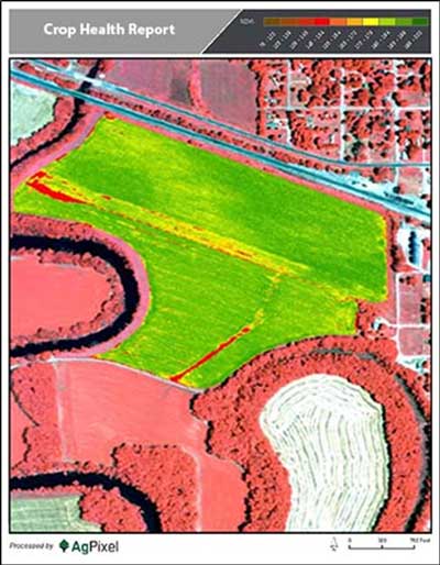
Near infra-red-capturing (NIR) sensors enable a normalized difference vegetative index (NDVI) analysis. The NDVI analysis serves to measure and map both crop stress and vigor. Production management software, under development, will allow an interface between aerially derived crop images, such as NDVI, and geo-referenced decision management tools. As these two technologies converge, geo-referenced management zones can be delineated. The grower or crop specialist should then be able to use this information to investigate crop anomalies, and site-specific crop management prescriptions can be recommended to enhance or protect yield.
Enhanced Crop Scouting
The most popular, simple, and ready-to-fly quad copter can carry a color visual camera capable of taking remarkably clear still and video images. The DJI Phantom™ and DJI Inspire™ quad copters are two such platforms used in aerial crop observations and enhanced crop scouting. The “bird’s eye view” afforded by these aerial platforms can be very powerful in helping evaluate overall crop health and vigor. This aerial perspective can give insight into differences in crop color, crop density, and other patterns or trends. This perspective may further aid in evaluating management practices associated with these observations. Another advantage of aerial is efficiency in helping direct crop scouting tasks, which enables the crop scout to cover acres faster and with greater focus on targeted field areas. Currently limitations of sUAS include battery life, the number of acres that can be covered in a day, and limited camera options.
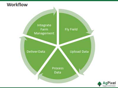
In comparison to the quad copters, fixed wing aircraft are much more efficient, with higher airspeeds and extended flight times of 45 minutes, to one hour per mission. Fixed wing aircraft can cover 150-500 acres in one flight, depending on field shape and size. The best models are launched with a pneumatic or bungee mechanisms or are hand launched. They fly a fully autonomous flight plan, capture geo-referenced, remotely-imaged data and return to a predetermined landing site, all while the images are being processed and “stitched together.” Data from the aircraft is transferred to “the cloud” while the aircraft is still flying.

Technology Evolution
As sUAS technology evolves, and advanced sensors become scalable for use on these aircraft, the systems’ value increases beyond the current pairing of visual camera with a quad copter. Expansion of guidance system nanotechnology, mission autonomy and flight stability, all integrated into a 5 pound fixed wing drone, could make a NASA flight engineer envious. Better still, these progressive options will be available to the consumer at relatively affordable prices. Farmers, technology support staff, and crop specialists will partner to extract the full utility out of the sUAS technology. High tech aerial platforms cannot replace the field savvy, boots-on-the-ground, field scout. The technology simply supports and aids the good agronomic decision-making that humans must still accomplish. Future articles will explore the detail of sUAS utility, what the current regulatory landscape looks like, and the potential implications to growers, crop specialists, and other stake-holders.
Ag Pixel images used with express permission
DJI Phantom and DJI Inspire are trademarks of Dajiang Innovation Technology Inc.